
Pomona ZIP Code Coverage
Four postal contexts appear in the Pomona research map. Three are commonly used for delivery geography, while 91769 is associated with PO Box use and should not be read as a residential polygon. The areas below are approximate. USPS's interactive lookup does not publish a stable narrative assigning every neighborhood or station, so an exact address must be checked in the live postal tool.
| ZIP | Areas Covered | Post-Office Context | Notes |
|---|---|---|---|
| 91766 | Central and south Pomona, Civic Center and Westmont-area addresses | Pomona delivery and postal facilities | Edge addresses need exact verification |
| 91767 | North and central Pomona | Pomona delivery | Postal label does not prove city jurisdiction |
| 91768 | West and northwest Pomona, including Fairplex-adjacent areas | Pomona delivery | Boundary approaches nearby cities |
| 91769 | PO Box mailing use associated with Pomona | PO Box context | Not a residential geography |
A ZIP result narrows a mail route. It does not produce a list of Pomona residents. Use the code as one clue, then move to an exact address, parcel, directory, court, or other record that answers the actual question.
Verify a Pomona Address First
The USPS city and state lookup is the first stop for a ZIP question. Search by city and state to find candidate codes, then run the exact address through the delivery lookup when the address is known. Directional prefixes, street suffixes, unit formats, and a misplaced house number can change the result. Keep the returned address format with the research notes.
The USPS form is a postal tool, not a jurisdiction database. After the postal result, compare the Pomona city boundary and annexation map, then use the LA County Assessor address search for the parcel. A mailing city can persist near a border even when the permit, planning, or sheriff custodian follows another city or county.
The captured USPS form shows the first step in the Pomona ZIP code directory workflow.
Open the USPS city and state ZIP lookup before using a ZIP as a search filter.
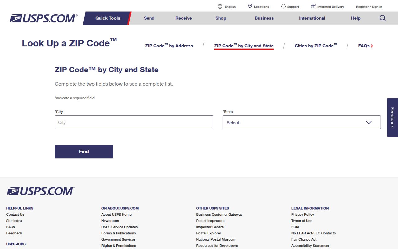
Use the exact returned delivery format to reduce false matches before checking a county parcel source.
Pomona 91766 and 91767 Geography
91766 covers central and south Pomona, including Civic Center and Westmont-area addresses in the research description. 91767 covers north and central Pomona. The line between the two is a postal division, not a complete statement about a neighborhood's history or a city's legal edge. A street at a transition should be tested by exact address rather than guessed from a broad area.
Use the ZIP code to narrow a resident or property question only after the address is known. The Assessor accepts an AIN or address, not a verified ZIP-wide browse. A directory or court search may also use a city or place name that includes nearby jurisdictions. Compare the address, city boundary, and source custodian before joining those results.
Pomona 91768 Meets the Edge
91768 is described as west and northwest Pomona, including Fairplex-adjacent areas. That geography approaches La Verne, Claremont, and West Covina-area jurisdictions. A postal result near the edge should be paired with the official county Pomona boundary and annexation map and, when a parcel question is involved, an AIN search.
Fairplex-adjacent land also shows why a ZIP code directory must stay precise about what it claims. Postal delivery, municipal planning, county assessment, and a historical directory may each use a different place label. Keep the postal code as a delivery fact, then ask the agency that owns the record to confirm the jurisdiction.
Note: A ZIP code can help locate a delivery route while still leaving the city, county, and record custodian unresolved.
Pomona 91769 PO Box Context
91769 is associated with Pomona PO Box mailing use in the research file. The Historical Society of Pomona Valley uses P.O. Box 1527, Pomona, CA 91769. That example shows why a postal code can identify a mailing channel without describing homes, streets, parcels, or a group of residents.
Do not use a PO Box code as a map polygon. For a person or organization, separate the mailing address from a physical address and verify the latter through the record custodian that holds it. A business filing, society contact page, or library address can be public role information without being a resident record.
- ZIP code
- A USPS delivery-area code that can cross municipal lines.
- ZIP+4
- An extended delivery code for a narrower route or location; it is not a household roster.
- PO Box ZIP
- A code used for box delivery that may not describe a residential area.
- Unique ZIP
- A code assigned to one organization or special delivery context rather than a broad neighborhood.
- Carrier route
- A postal delivery path inside a broader ZIP area.
- City boundary
- A municipal line that may not match postal place labels.
Locate Pomona Residents by ZIP Code
Finding residents by ZIP code takes a second key. Start with a candidate address or name, confirm the exact postal code with USPS, and then choose the record that answers the question. The ZIP code directory can narrow a search for a Pomona address, but it cannot replace a parcel, court, vital, directory, or official self-verification result.
- Use USPS city and state lookup to identify candidate ZIP codes and exact-address formatting.
- Check the county Pomona boundary and annexation map when the address is near a city edge.
- Search the Assessor by address or AIN; record the parcel key rather than expecting a ZIP-wide owner list.
- For a current person question, use the relevant court, vital, business, license, or private voter-status route.
- For an older household, move from the ZIP clue to a street, directory edition, census, obituary, or deed.
A ZIP code directory result should state whether it came from USPS, a county parcel, a historical volume, or another source. That small label keeps a delivery fact from becoming a claim about a person.
Once the ZIP narrows the address, the next useful step is the Pomona street directory by address, where the parcel and street record chain can be checked without treating the ZIP as a resident list.
Why Pomona Assessor Skips ZIP Browsing
The public Los Angeles County Assessor Portal is address and AIN based. The research capture did not find a verified public mode that lists every parcel or person in a ZIP. That is a useful gap to state plainly. A ZIP-wide screen would still not be a residents directory because the portal suppresses owner-name searching online and parcel geography can cross a postal or city line.
Use the address or AIN route, then pan the map if the first form fails. The closest cross streets, a corner-lot variant, a multi-unit format, or a deleted parcel can change the path. A parcel map and parcel detail page also update on different cycles, so a recent change may not appear in both at once.
| Assessor Field | Type | ZIP Directory Use | Limit |
|---|---|---|---|
| Search by AIN or Address | Text or autocomplete | Test one exact address | No verified ZIP-wide browse |
| Basic Search | Button or tab | Open public parcel route | Owner name absent online |
| Legal Search | Tab | Check description clues | Not a ZIP assignment tool |
| Map Search | Tab | Review nearby parcels | Map is not a survey |
When the ZIP clue points to a city-created record, Pomona's City Clerk and the department that owns the file are the next contacts. A useful request names the address, AIN, date range, record type, and preferred electronic format. The California Public Records Act can require a custodian to search for a reasonably described existing record, but it does not require an office to create a ZIP directory or answer an open-ended question about every person in an area.
For a parcel near the edge, compare the postal return, Assessor situs, and municipal boundary before requesting permits or code files. If the land is outside incorporated Pomona, LA County planning or another city's department may be the right custodian. That jurisdiction check is part of ZIP research, not an optional extra.
Use Pomona's Edge Map
The official county annexation map places Pomona in a complicated eastern Los Angeles County setting near Diamond Bar, Industry, Walnut, Claremont, La Verne, and San Bernardino County. It is the right companion to a ZIP search when the postal city and the incorporated city appear to disagree. The map does not assign every delivery address, so USPS remains the exact-address source.
For a planning or permit request, check the city boundary before choosing a custodian. Pomona-created records stay with Pomona departments; a nearby unincorporated or neighboring-city parcel may follow a different planning or county system. A resident lookup that uses a ZIP alone can send a request to the wrong office.
City engineering, planning, and county survey records are the better sources for a street dedication or address assignment. Use the ZIP to find the likely area, then let the mapped boundary and exact situs decide which Pomona office should receive the request.
Check the Los Angeles County Pomona boundary map when a ZIP result sits near the edge.
Pomona ZIP Code Boundaries vs City Limits
Postal Pomona and incorporated Pomona overlap without being identical. ZIP codes describe delivery, city limits describe municipal authority, and county boundaries describe the records layer. A street can use a Pomona mailing label while its permit, school, sheriff, or planning record follows another jurisdiction. A PO Box can use a Pomona ZIP without describing any physical parcel.
Boundary check. Treat a ZIP as a routing clue. Confirm an exact deliverable address with USPS, the city or county map, and the custodian that owns the record before making a claim about a Pomona person or parcel.
No dated official ZIP split or realignment narrative was located for this build, and USPS does not publish a stable neighborhood assignment table. That gap belongs in the result. Exact-address verification is more reliable than a guessed boundary story, especially near Fairplex, Westmont, or the eastern county edge.